



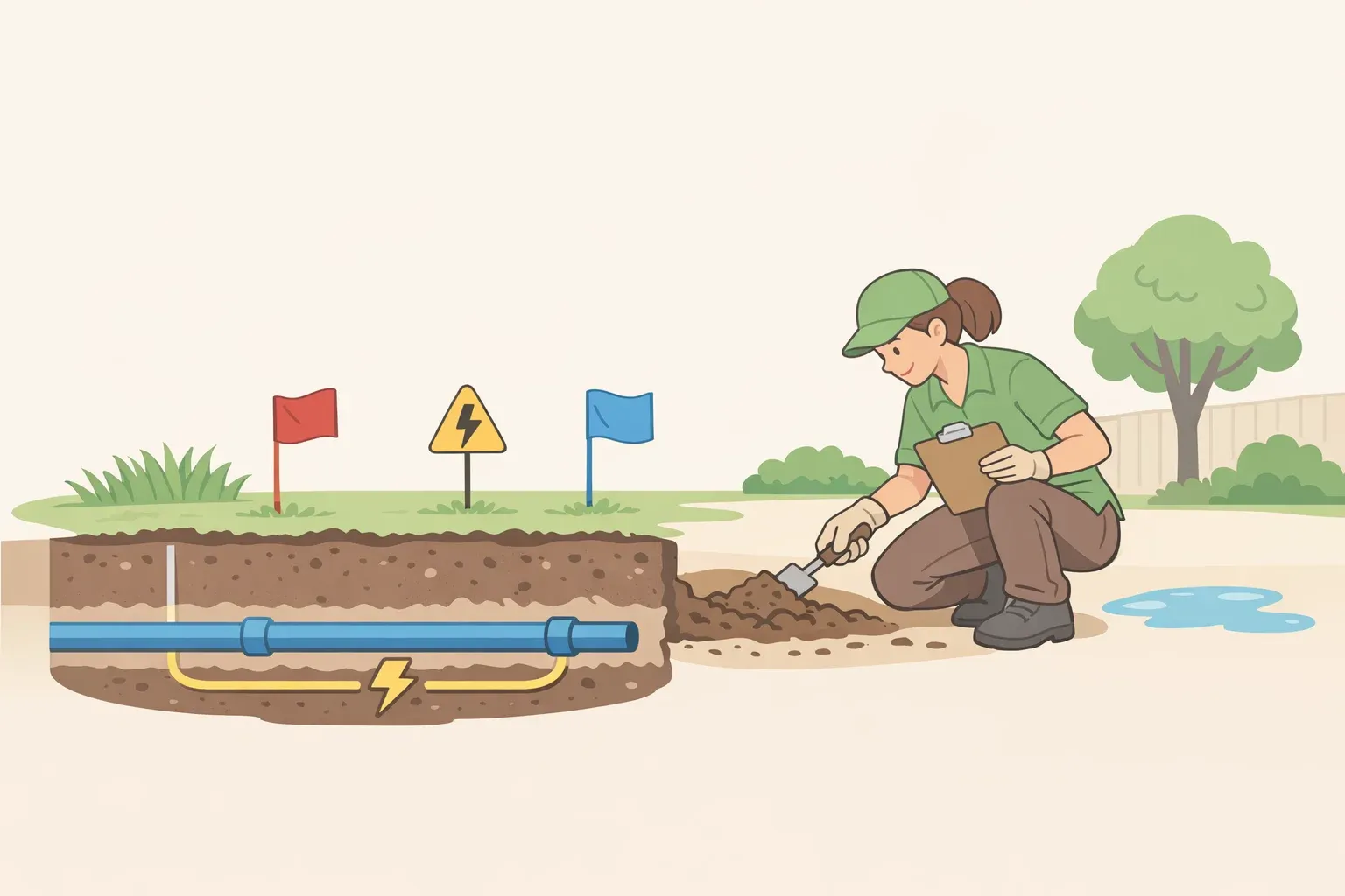
Most homeowners start a yard project with a plant list, a saved photo, or a strong opinion about hydrangeas. Landscape designers start somewhere else entirely: with water, dirt, and buried pipes.
Before any plant gets chosen, a professional reads the site in a specific sequence. First come the risks and hard limits: water behavior, slope, buried utilities. Then comes an inventory of what's already there and worth keeping, mature trees especially.
Then comes a read on how the household actually lives in the space. Only after all of that does anyone talk about design, let alone plants. This is what landscape designers look for in a yard, and the order matters as much as the checklist itself.
A workable, attractive landscape has to be built from a careful review of a site's specific conditions, intended use, and resource demands, not a template stamped down regardless of context.
Skipping that review is expensive: landscape maintenance professionals estimate that 90% of maintenance headaches trace back to problems that should have been caught during the initial site assessment. The whole approach rests on one guiding rule, "right plant, right place," which treats plant selection as a downstream decision rather than a starting point.
Think of it as the outdoor version of a contractor checking a house's foundation and wiring before anyone opens a paint chip fan. Nobody picks a color until they know the walls will hold.
Here's why each stage earns its place, how a homeowner can run the same walk-through, and where it should stop in favor of a specialist.
How to evaluate your yard for landscaping: start with constraints
The first pass through a yard has nothing to do with beauty. It's about what limits or endangers every decision that comes later.
Elevation, slope, and grade get mapped early because they're critical to drainage, grading, and how people actually circulate through the space. Flood- or pooling-prone spots get flagged too, since they help guide where a swale, a retention area, or a permeable surface might go, rather than dictating one fix over another, per the same source. Soil type and permeability matter just as much: they shape both what can grow and what can safely be built, including patios, walls, or other structures.
Then there's the part no visual walk-through can reveal: what's underground. In Illinois, homeowners are told to call JULIE at 811 before any digging, whether for planting, edging, or grading. Every state runs its own version of that one-call utility service, and it's worth locating and contacting before breaking ground anywhere, since buried lines simply aren't something you can eyeball from the surface.
Zoning rules, easements, and site history round out this stage. They can rule out certain changes entirely, regardless of what the yard seems to "need" aesthetically.
A homeowner can gather most of this without any special equipment:
Walk the yard the morning after a hard rain and note where water pools, where it sheets off, and how close it gets to the foundation.
Track sun and shade at a few points across the day, not just at midday, since the picture shifts noticeably by afternoon.
Note any grade change within a few feet of the foundation, especially one that seems to pitch water toward the house rather than away from it.
What's harder to judge without training is whether a wet spot is a simple regrading fix or a sign of something more serious underneath. That's usually the point where it's worth calling someone who reads drainage for a living rather than guessing.
None of this is more interesting than picking out a flowering shrub. It gets checked first because water, grade, and utilities set the boundaries of what's possible before anything else gets evaluated. Once those boundaries are known, the next question is what's already standing inside them.
What's already there and worth protecting
Existing trees, native species, and habitat features get inventoried before any new element enters the conversation, because they guide what should be preserved versus what can reasonably be changed. Trees are usually a landscape's dominant structural feature, and they're meant to be placed deliberately, as a single specimen, a grouping, or a mass, not scattered without a plan.
Rooting space is where this gets concrete and checkable. A tree with a 16-inch trunk diameter needs roughly 1,000 cubic feet of soil, or about a 32-foot square, to reach maturity, a figure that instantly rules out planting large species near foundations, driveways, or narrow side yards.
Get that math wrong, and it shows up years later: the average landscape tree lives less than 20 years, and CSU Extension traces that shortfall to poor design and planting technique. Limited rooting space specifically drags down a tree's size, growth rate, vigor, and lifespan, per the same source.
The payoff for getting it right is measurable. Properly placed trees can cut air-conditioning demand by 10 to 30 percent, and block 70 to 90 percent of solar radiation on a clear summer day, per the same research. Those figures come from Colorado-specific studies and will shift with climate, but they make the underlying point clearly enough: designers treat mature trees as performance assets, not decoration.
Not every mature tree earns the same treatment, and sorting that out is worth doing before any design gets drawn:
A tree with a full, unobstructed canopy and no visible root heaving near hardscape is usually a straightforward case for protecting outright.
A tree with roots already breaking through a driveway or lifting a walkway is a case for working around, not necessarily removing. That call belongs to an arborist, not a guess.
Rough canopy spread is worth noting, since it hints at how far roots may extend and where a future patio or addition might run into conflict.
These are observations, not diagnoses. Reading whether a stressed tree needs intervention is a job for someone trained to interpret bark, roots, and canopy, not a homeowner with a tape measure.
Call this stage "protect before you plant." It's a chance to size up what already works before adding anything new that might compete with it, shade it out, or crowd its roots. Once the site's risks are mapped and its assets are protected, the next question turns from the ground itself to the people walking on it.
How the household actually uses the yard
Physical conditions set the boundaries of a yard. How people actually move through and live in that space determines what should go inside those boundaries. Landscape design decisions follow directly from how a space will be used day to day, a factor CSU Extension treats as being assessed alongside physical site conditions, not after them.
That starts with movement. Designers trace pedestrian, pet, and vehicle routes through a yard because those paths determine where surfaces, plantings, and barriers can and can't go. Sightlines get the same treatment: which views are worth framing, which need screening for privacy, evaluated from the vantage points people actually use rather than a straight-on look at the front of the house.
That use-based thinking leads to a practical, low-cost principle: limit water-intensive turf to the areas people actually use heavily, instead of irrigating an entire lawn uniformly regardless of foot traffic.
DIY plans often overlook a key question: How much time, water, and other resources can the household realistically devote to yard maintenance? CSU Extension recommends considering this during the design stage because it can determine whether the yard remains enjoyable or becomes a burden.
A useful exercise here doesn't require a notebook full of measurements, just attention to one ordinary weekday:
Where do the trash and recycling bins actually go, and is the path to the curb clear?
Where does the dog run, and has it already worn a track into the grass?
Where do deliveries land, and where do cars actually park, versus where the driveway was designed for them to park?
Which patches of lawn get walked on or played on, and which just get mowed?
Worn paths and ignored corners tend to be more honest than any wish list. They show how a yard is actually being used, not how someone imagines using it. With risks mapped, assets protected, and use patterns understood, the assessment has done its job. What's left is turning all of that observation into an actual plan.
Turning the assessment into a plan
The last stage is where observation turns into decision, and it runs in the same order the assessment did. The findings from the first three stages get recorded and ranked before any design choice is made: constraints and risks first, then assets worth protecting, then use zones, with aesthetics entering last.
Plants then get grouped into what's called hydrozones, clusters organized by water need, so irrigation matches actual demand rather than treating an entire yard as one uniform watering zone.
Native or regionally adapted planting is one design response that can emerge from this process, not a required aesthetic. Prairie-style native plantings are often described by extension professionals with a specific adage: they sleep the first year, creep the second, and leap the third, spending that opening season building root systems underground before top growth catches up.
Maintenance needs should diminish once plants are established, though the same source is careful to note they don't vanish; weed control and occasional deep watering during severe drought stay part of the picture.
The clearest way to see this bridge in action is to trace one observation through to one decision. A patio that bakes in afternoon sun on the west side of the house points toward a shade strategy, whether that's a tree, a pergola, or moving the patio somewhere else.
A low spot that stays wet after rain points toward leaving that area alone rather than paving over it. A stretch of lawn nobody walks on points toward shrinking the irrigated footprint instead of watering it out of habit. None of these are dramatic insights. They're just what happens when the assessment is allowed to drive the decision instead of the other way around.
A simple deliverable a homeowner can produce without professional help: a one-page site sketch with headings for water flow, sun and shade through the day, soil, existing trees, utilities and easements, sightlines, and use routes.
That's the same set of categories a professional assessment covers, just scaled down into something walkable in an afternoon. "Design response" isn't an independent style choice layered on top of a yard. It's the direct output of everything observed before it.
Where the walk-through ends and a specialist begins
The sequence above — constraints, then assets, then use, then design — is a lens worth running any yard through once. Doing it produces something concrete: that one-page sketch of water flow, sun and shade, soil, trees, utilities, sightlines, and use routes.
That sketch is worth more than a mood board. It's the brief a homeowner can hand to a designer, an arborist, or a drainage specialist, and it will save all three time, because the site's constraints are already documented instead of getting rediscovered on a first visit.
Some situations are worth flagging for a professional rather than pushing through alone. Standing water that lingers well after rain, a grade change near the foundation that looks like more than cosmetics, any significant tree work, and excavation anywhere near buried lines are all reasonable moments to bring in a drainage professional, certified arborist, or utility locator instead of guessing. None of those calls need to be made solo.
There are published detailed, free guides on hydrozoning, tree placement, and native plant selection for anyone who wants to go further on any of the four stages. Some of the specific figures involved — irrigation specs, shade geometry — are climate-specific, so it's worth checking them against a source local to the reader's own region before treating them as universal.





Comments
Be the first, drop a comment!